

Topographic Survey of a Building
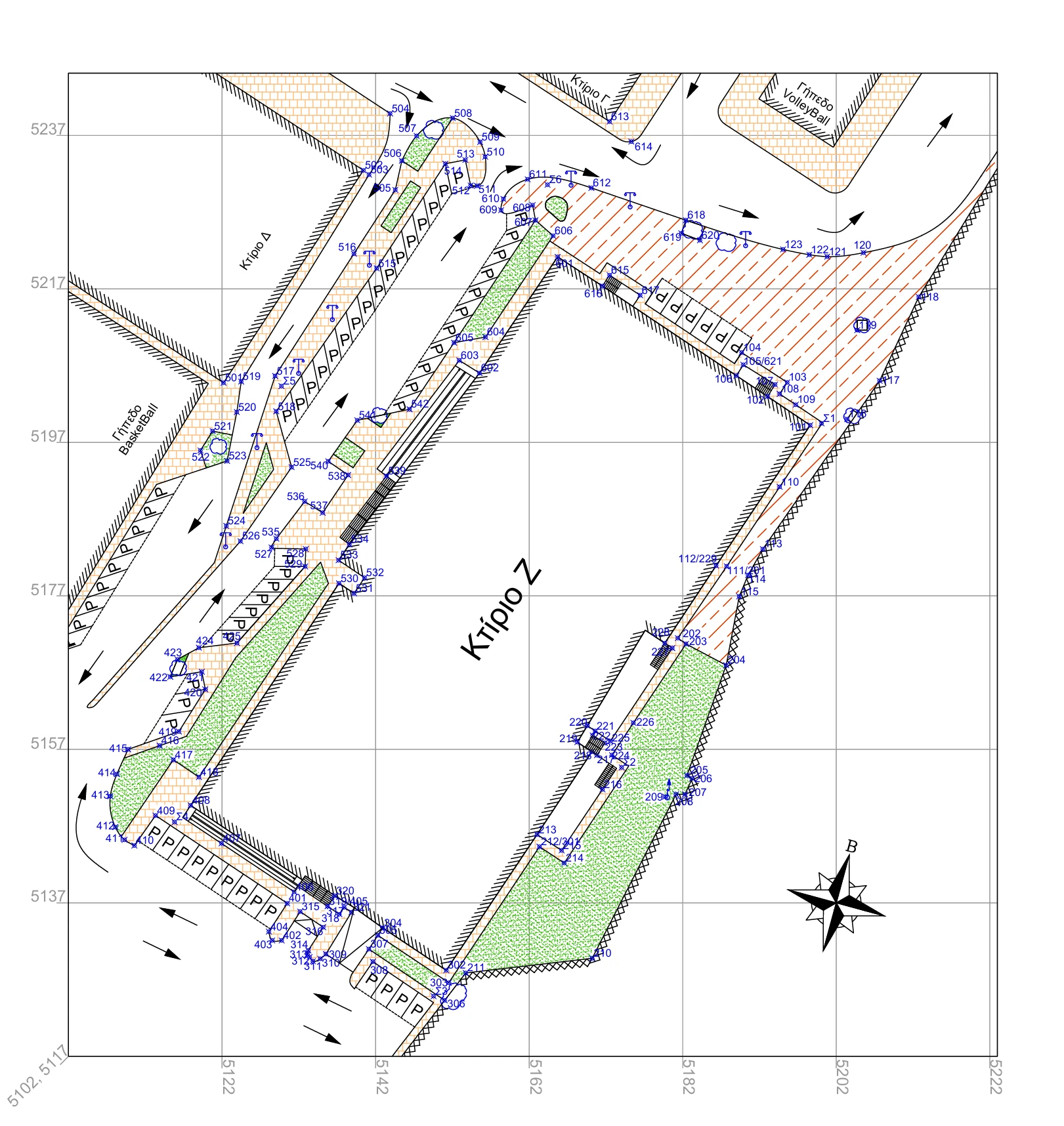
A team fieldwork project surveying a large building on the UNIWA campus.
Instruments & methodology
- Total station - recording horizontal and vertical angles and distances, with control points set up around the building
- Levelling instrument - precise determination of height differences and elevation control
Deliverables
The field measurements were processed and drawn up as a topographic plan of the building and its surroundings, produced in AutoCAD.
What I took from it
Setting up and orienting instruments in the field, systematic recording of measurements, error checking and closing traverses, and turning raw field data into accurate drawings.